TOPO
LiDAR topo contours for septic site planning
SepticPro surfaces topographic context for septic jobs so contractors can reason about slope, drainage, access, and field placement before the permit package is finished.
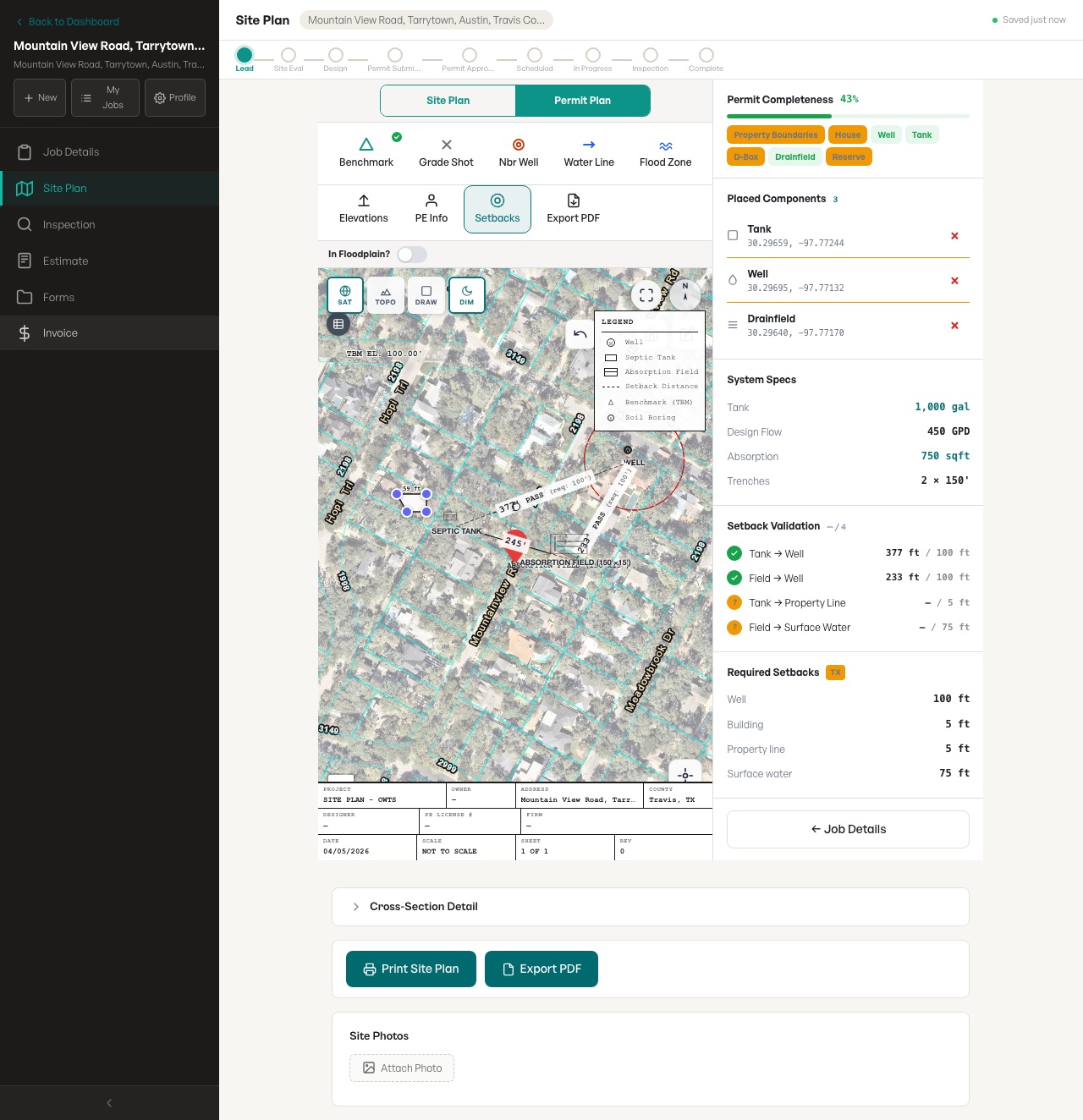
Actual site-plan builder screenshot
This feature connects to the SepticPro site-plan workspace shown here: parcel imagery, septic objects, setback validation, and export controls in a real test job.
- Visible workflow
- Parcel-aware site plan with septic objects on a real map layer
- Visible review
- Setback validation and required setback values shown beside the drawing
- Limit
- AI and maps accelerate drafting; contractor verification is still required
What this page covers
- Show contour context while placing tanks, lines, fields, and reserve areas.
- Help identify steep, low, or awkward areas before the design is finalized.
- Support conversations with homeowners, installers, and reviewers.
- Reduce back-and-forth caused by layouts that ignore terrain.
Search topics
- LiDAR contours septic
- topographic septic site plan
- septic slope planning
Related septic contractor workflows
Frequently asked questions
Does topo data replace field verification?
No. It helps planning, but field measurements, soil evaluation, and local requirements still control the final design.
Why does slope matter for septic contractors?
Slope can affect drainfield placement, line routing, pump needs, access, erosion risk, and how easily a system can be installed.