PARCEL MAPS
Parcel boundary mapping for septic contractors
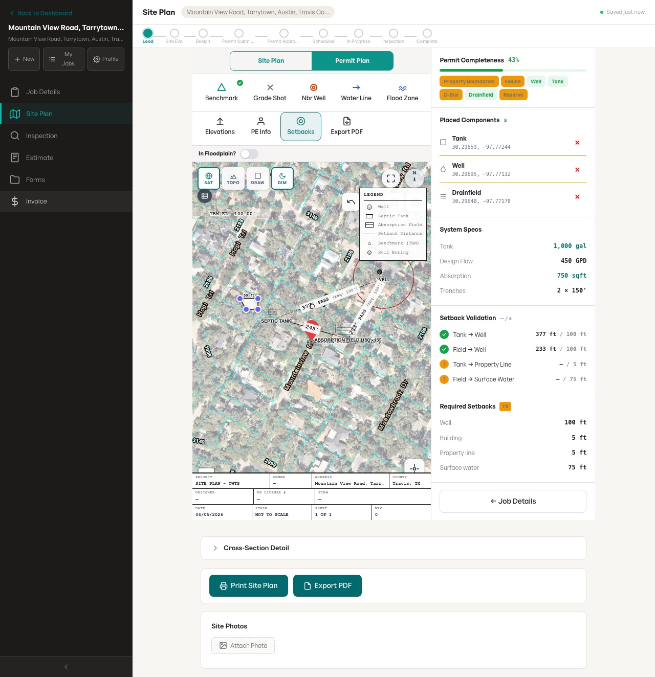
SepticPro gives septic contractors parcel-aware site planning so tanks, fields, reserve areas, structures, and setbacks are drawn against the right lot instead of an approximate screenshot.
Actual site-plan builder screenshot
This feature connects to the SepticPro site-plan workspace shown here: parcel imagery, septic objects, setback validation, and export controls in a real test job.
- Visible workflow
- Parcel-aware site plan with septic objects on a real map layer
- Visible review
- Setback validation and required setback values shown beside the drawing
- Limit
- AI and maps accelerate drafting; contractor verification is still required
What this page covers
- Display property boundaries behind the site-plan drawing canvas.
- Use lot lines as a practical reference for tanks, fields, wells, and structures.
- Handle jobs where the usable property includes adjacent parcels.
- Keep the parcel visible in review and export workflows.
Search topics
- parcel boundary map
- septic parcel map
- property line site plan
Related septic contractor workflows
Frequently asked questions
Can a contractor combine two adjacent parcels?
Yes. The intended workflow is to add adjacent parcels to the job so the site plan can show a combined property boundary when the project uses both lots.
Is a parcel boundary a survey?
No. Parcel layers are useful planning context, but they do not replace a survey where a county or engineer requires one.